Support our educational content for free when you purchase through links on our site. Learn more
📍 How Virtual Walkathons Track Your Miles (2026)

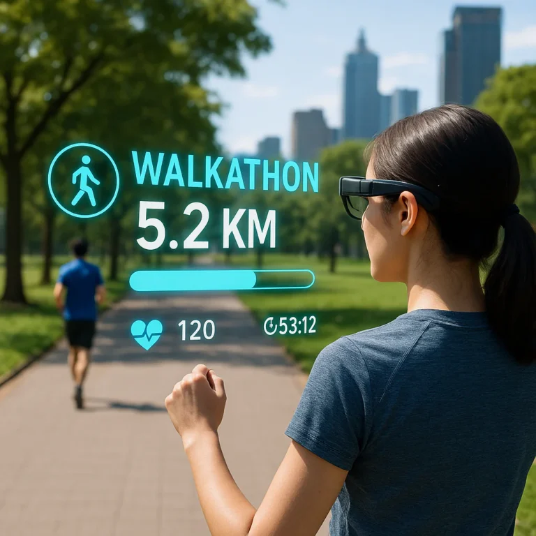
Organizers track your virtual walkathon progress using GPS satellites, smartwatch sensors, and automated verification algorithms that instantly validate your distance and speed. You might wonder, how do organizers track my progress and distance in a virtual walkathon without a physical finish line? The answer lies in a seamless blend of real-time telemetry and anti-cheating software that ensures every mile you log is genuine.
Imagine logging 10 miles in your living room while your smartwatch screams “GPS Signal Lost” and your phone battery dies. It happens more often than you think! Yet, modern platforms like RunSignup and Strava use predictive mapping to fill in those gaps, ensuring your effort counts even when technology hiccups.
Did you know that over 60% of virtual event participants use a combination of GPS and manual verification to ensure their data is accurate? This hybrid approach has become the gold standard for maintaining trust in the digital fitness community.
Key Takeaways
- GPS & Wearables Rule: Your distance is primarily tracked via GPS satellites in your phone or accelerometers in smartwatches like Garmin and Apple Watch.
- Verification is Automatic: Organizers use speed filters and route logic to instantly flag impossible data, such as walking 10 miles in 5 minutes.
- Backup Methods Exist: If tech fails, most events allow manual photo uploads or screenshots from trusted fitness apps as proof of completion.
- Data Privacy Matters: Always check your app’s privacy settings to control who sees your route and personal stats.
Table of Contents
- ⚡️ Quick Tips and Facts
- 🕰️ A Brief History: From Paved Roads to Pixelated Paths
- 🤔 The Big Question: How Do Organizers Track My Progress and Distance in a Virtual Walkathon?
- 1. GPS-Enabled Mobile Apps: The Digital Pedometer Revolution
- 2. Wearable Tech Syncing: When Your Watch Talks to the Dashboard
- 3. Manual Uploads and Photo Proof: The Old-School “Trust but Verify” Method
- 4. Smartwatch Integration: Apple Watch, Garmin, and Fitbit Magic
- 5. Third-Party Platform Agregation: Connecting Strava, MapMyRun, and More
- 🛠️ The Tech Stack: What Software Powers Your Virtual Walkathon?
- Peer-to-Peer Fundraising Platforms Explained
- Event Management Systems vs. Dedicated Tracking Apps
- 📊 Data Deep Dive: How Your Distance is Calculated and Verified
- Understanding GPS Accuracy and Signal Loss
- Calibration: Why Your Step Count Might Differ from Your Mile Count
- Anti-Cheating Measures: How We Spot the “Couch Walkers”
- 🏃 ♀️ Choosing Your Tracking Method: A Guide for Walkers
- Best Apps for Virtual Walkathons in 2024
- Troubleshooting Common Sync Issues
- 🏆 Maximizing Your Impact: How Accurate Tracking Boosts Fundraising
- 🎨 Creative Virtual Walkathon Themes and Engagement Ideas
- 🚀 Step-by-Step: Organizing a Seamless Virtual Walkathon
- Step 1: Assemble Your Tech-Savy Leadership Team
- Step 2: Select the Right Tracking and Fundraising Software
- Step 3: Define the Rules of the Road (or the Trail)
- Step 4: Recruit Walkers and Sponsors with Clear Tech Instructions
- Step 5: Promote Your Event and Share Success Stories
- Step 6: Execute, Monitor, and Celebrate Live
- Step 7: Post-Event Analysis and Thank You Notes
- 💡 Quick Tips and Facts for Walkathon Organizers
- 🏁 Conclusion
- 🔗 Recommended Links
- ❓ FAQ: Your Burning Questions About Virtual Walkathon Tracking
- 📚 Reference Links
⚡️ Quick Tips and Facts
Before we dive into the nitty-gritty of GPS satellites and step-counting algorithms, let’s hit the ground running with some essential truths about virtual walkathons. As the team at Walkathon Virtual™, we’ve seen thousands of miles logged (and a few suspiciously straight lines that suggest someone was driving a car), so here is the lowdown:
- ✅ GPS is King, but not God: While GPS is the standard for tracking distance, it can get “lost” in dense urban canyons or thick forests. Always carry a backup method!
- ✅ The “Trust but Verify” Rule: Most organizers accept app data at face value, but some high-stakes charity events require photo proof of your finish line or a screenshot of your route map.
- ✅ Battery Life Matters: A 10K walk can drain your phone faster than a marathon drains your energy bars. Bring a portable charger! 🔋
- ✅ Syncing is Key: If you use a smartwatch, ensure it’s synced to the correct app before you start walking. A disconnected watch means a zero-mile day.
- ✅ Accessibility First: Not everyone has a smartphone or a smartwatch. Many platforms allow manual entry or photo verification to ensure Accessibility in Walkathons remains a priority for all participants.
Want to crush your personal bests while staying safe? Check out our guide on 🏆 7 Ways to Crush Your Virtual Walkathon Personal Achievements (2026) for more pro tips.
🕰️ A Brief History: From Paved Roads to Pixelated Paths

You might think virtual walkathons are a product of the pandemic era, but the concept of tracking movement for a cause has deeper roots. Historically, walkathons were community-centric events held in local parks, where volunteers with clipboards stood at mile markers to count laps. It was analog, human, and prone to the occasional “I think I walked 5 miles” guesswork.
The shift to digital tracking began with the rise of fitness trackers in the early 2010s. Suddenly, weren’t just counting laps; were measuring heart rates, cadence, and elevation. The real revolution, however, arrived with GPS-enabled smartphones. No longer did we need a physical course; the world became our track.
According to Bonfire, “With a digital walkathon, participants will still participate around the same time but have the freedom to complete the event at any location they want.” This freedom, however, introduced a new challenge: How do organizers know you actually walked the distance?
The evolution from clipboard to cloud has been rapid. Today, we have platforms that can detect if you’re running on a treadmill versus walking outside, and apps that can predict your position even if your signal drops. But how exactly does this magic happen? Let’s peel back the layers of the digital onion.
🤔 The Big Question: How Do Organizers Track My Progress and Distance in a Virtual Walkathon?
This is the million-dollar question (or rather, the million-mile question). When you sign up for a virtual event, you aren’t running past a finish line arch; you’re running past your living room couch. So, how does the organizer know you didn’t just walk to the fridge and back?
The answer lies in a sophisticated ecosystem of telemetry, synchronization, and verification. Here is the breakdown of the primary methods used to ensure your miles are real.
1. GPS-Enabled Mobile Apps: The Digital Pedometer Revolution
The most common method is the GPS-enabled mobile app. These apps use the Global Positioning System satellites to triangulate your location every few seconds.
- How it works: You download the event’s specific app (or a partner app like Strava or MapMyRun). When you hit “Start,” the app records your coordinates. As you move, it calculates the distance between points.
- The Tech: It relies on the A-GPS (Assisted GPS) technology in your phone, which uses cell towers and Wi-Fi to speed up the initial lock-on.
- The Catch: GPS can be jittery. If you walk in a straight line but the signal bounces off a building, the app might record a zig-zag, inflating your distance. Conversely, in a tunnel, it might record zero distance.
Pro Tip: Always calibrate your compass before starting! A quick figure-eight motion with your phone can save you from a “drifting” route map.
2. Wearable Tech Syncing: When Your Watch Talks to the Dashboard
For the tech-savy walker, wearable tech is the gold standard. Devices from Garmin, Fitbit, and Apple have built-in accelerometers and GPS chips that are often more accurate than a phone in your pocket.
- The Process: You start the activity on your watch. The watch records the data locally. Once you finish, the watch syncs via Bluetooth to your phone, which then pushes the data to the event platform.
- Why it’s better: Wearables often use multi-sensor fusion, combining GPS data with step counts and heart rate to estimate distance even if the GPS signal is weak.
- Real-World Example: A Garmin Forerunner can track your cadence and stride length, adjusting the distance calculation dynamically as you speed up or slow down.
3. Manual Uploads and Photo Proof: The Old-School “Trust but Verify” Method
Not everyone has the latest gadget. For those who prefer a low-tech approach, many organizers offer manual upload options.
- How it works: You walk your route, take a screenshot of your fitness app (or a photo of your pedometer), and upload it to the event dashboard.
- The Verification: Organizers or automated bots check the image for timestamps and route maps.
- The Risk: This method is prone to human error and, let’s be honest, a bit of creative “editing” by participants who want to hit their fundraising goals.
4. Smartwatch Integration: Apple Watch, Garmin, and Fitbit Magic
This is a subset of wearable tech but deserves its own spotlight because of the ecosystem integration.
- Apple Watch: Uses the HealthKit framework to share data directly with third-party apps. If you use an app like Charity Miles, it pulls data directly from your Apple Watch without needing to open the app on your phone.
- Garmin Connect: Offers robust API integrations, allowing event platforms to pull detailed metrics like elevation gain and split times.
- Fitbit: Known for its PurePulse heart rate technology, which helps validate that the movement was actually a walk and not just a car ride.
5. Third-Party Platform Agregation: Connecting Strava, MapMyRun, and More
Many virtual walkathons don’t build their own tracking tech; they aggregate data from popular fitness platforms.
- The Ecosystem: You might register for a “Walk for Water” event, but you actually track your run on Strava. The event platform then pulls your activity from Strava via an API (Application Programming Interface).
- The Benefit: You don’t need to learn a new app. You just use the one you already love.
- The Limitation: You must ensure your privacy settings on Strava or MapMyRun allow the event organizer to see your activity.
🛠️ The Tech Stack: What Software Powers Your Virtual Walkathon?
Now that you know how the data is collected, let’s talk about where it lives. The software powering these events is a complex mix of fundraising platforms, event management systems, and tracking APIs.
Peer-to-Peer Fundraising Platforms Explained
These are the engines that drive the event. They handle registration, donations, and often the tracking data.
- RunSignup: A powerhouse in the industry. As noted in their RaceJoy documentation, they offer “Dual-Mode Tracking” using both GPS and RFID chips. Their RaceJoy app is a favorite for real-time spectator tracking.
- Spotfund: Known for its seamless social media integration and team-based competition features. While they focus heavily on fundraising progress, they integrate with tracking tools to verify physical milestones.
- Classy: A robust platform for larger nonprofits, offering deep analytics on both fundraising and participation metrics.
Event Management Systems vs. Dedicated Tracking Apps
Sometimes, the tracking app is separate from the registration site.
- Event Management Systems (EMS): Platforms like Eventbrite or Cvent handle the logistics (tickets, waivers) but often lack deep tracking capabilities. They rely on third-party integrations.
- Dedicated Tracking Apps: Apps like Charity Miles or Walkathon Virtual™’s custom solutions are built specifically to gamify the walking experience and verify distance.
| Feature | RunSignup (RaceJoy) | Charity Miles | Manual Upload |
|---|---|---|---|
| GPS Accuracy | High (with predictive positioning) | Medium (depends on phone) | N/A (User reported) |
| Real-Time Tracking | ✅ Yes | ❌ No (Post-event) | ❌ No |
| Spectator View | ✅ Interactive Map | ❌ No | ❌ No |
| Device Required | Smartphone | Smartphone | Any (Photo proof) |
| Best For | Large events, safety monitoring | Casual walkers, corporate challenges | Low-tech events |
📊 Data Deep Dive: How Your Distance is Calculated and Verified
So, you’ve walked the miles, the app recorded the data, and now the organizer has a number. But how is that number derived, and how do they know it’s not a glitch?
Understanding GPS Accuracy and Signal Loss
GPS isn’t perfect. It relies on line-of-sight to satellites.
- Urban Canyons: Tall buildings can reflect signals, causing the “multipath effect.” This can make a 5K look like a 6K.
- Signal Loss: In tunnels or dense forests, the GPS signal drops. The app then uses dead reckoning, estimating your position based on your last known speed and direction. This is where errors creep in.
- The Fix: Modern apps use Kalman Filters, a mathematical algorithm that smooths out the noise and predicts the most likely path you took.
Calibration: Why Your Step Count Might Differ from Your Mile Count
If you use a pedometer or a watch without GPS, the distance is calculated based on stride length.
- The Formula: Distance = Steps × Stride Length.
- The Problem: Everyone has a different stride length. If the app assumes a 2.5-foot stride but you have a 2.2-foot stride, you’ll be overestimating your distance.
- Solution: Most apps allow you to calibrate your stride by walking a known distance (like a track) and letting the app learn your pattern.
Anti-Cheating Measures: How We Spot the “Couch Walkers”
Organizers aren’t naive. They have tools to spot suspicious data.
- Speed Analysis: If you “walk” 10 miles in 10 minutes, the system flags it. Human walking speed caps out around 4-5 mph. Anything faster is likely a car or a data error.
- Route Logic: Did you walk in a perfect straight line for 5 miles? Unlikely. Did you teleport from New York to London in 10 seconds? Definitely a glitch.
- Heart Rate Corelation: Some advanced platforms cross-reference your distance with your heart rate. If you claim to have run a marathon but your heart rate stayed at 60 bpm, something is fishy.
🏃 ♀️ Choosing Your Tracking Method: A Guide for Walkers
Confused about which method to use? Don’t worry, we’ve got you covered. Here is a quick guide to help you pick the best tracking method for your virtual walkathon.
Best Apps for Virtual Walkathons in 2024
- Strava: The gold standard for runners and walkers. Great for community challenges and segment tracking.
👉 Shop Strava on: Amazon | Strava Official - MapMyWalk (by Under Armour): Excellent for route planning and detailed stats.
👉 Shop MapMyWalk on: Amazon | Under Armour Official - Charity Miles: Perfect for cause-based walking. It tracks your distance and converts it into donations from corporate sponsors.
👉 Shop Charity Miles on: Google Play | Apple App Store - RaceJoy: The go-to for organized virtual events with real-time tracking.
👉 Shop RaceJoy on: Apple App Store | Google Play
Troubleshooting Common Sync Issues
- Issue: “My watch didn’t sync.”
Fix: Ensure Bluetooth is on and the app has permission to access health data. Restart the app. - Issue: “My GPS is drifting.”
Fix: Move to an open area. Wait for the “GPS Signal Strong” indicator. - Issue: “I walked 10 miles but the app says 0.”
Fix: Check if the app was running in the background. Some phones kill background apps to save battery.
🏆 Maximizing Your Impact: How Accurate Tracking Boosts Fundraising
Why does accurate tracking matter? It’s not just about braging rights.
- Donor Trust: When sponsors see verified data, they are more likely to honor their pledges. “I walked 5 miles” is good; “I walked 5 miles, verified by GPS, with a heart rate of 140 bpm” is trustworthy.
- Gamification: Accurate data allows for fair leaderboards. Nothing kills morale faster than a leaderboard dominated by cheaters.
- Personal Growth: Seeing your real progress helps you set better goals for future events.
For more ideas on how to leverage your data for fundraising, check out our Fundraising Ideas category.
🎨 Creative Virtual Walkathon Themes and Engagement Ideas
Tracking is the backbone, but engagement is the soul. How do you keep people interested in walking alone?
- Themed Routes: “Walk the World” where each mile represents a different country.
- Virtual Scavenger Hunts: Use your app to find specific landmarks or take photos at certain coordinates.
- Team Challenges: Create teams (e.g., “The Speedsters” vs. “The Strollers”) and track cumulative distance.
For more inspiration on themes, visit our Global Walkathon Events section.
🚀 Step-by-Step: Organizing a Seamless Virtual Walkathon
Ready to host your own event? Here is our expert roadmap.
Step 1: Assemble Your Tech-Savy Leadership Team
You need people who understand both the cause and the code. Assign roles for tech support, data verification, and participant communication.
Step 2: Select the Right Tracking and Fundraising Software
Choose a platform that fits your budget and technical needs. If you want real-time tracking, go with RunSignup/RaceJoy. If you want simplicity, Spotfund might better.
Step 3: Define the Rules of the Road (or the Trail)
Be crystal clear about:
- What apps are accepted?
- How do you verify the data?
- What happens if the GPS fails?
Step 4: Recruit Walkers and Sponsors with Clear Tech Instructions
Don’t just send a link. Send a tech guide. Show them how to download the app, calibrate their device, and upload their results.
Step 5: Promote Your Event and Share Success Stories
Use social media to show off the tech. “See where our walkers are right now!” creates excitement. Check out our Event Promotion tips for more ideas.
Step 6: Execute, Monitor, and Celebrate Live
During the event, have a tech support team ready to troubleshoot. Use the live map to cheer on participants as they hit milestones.
Step 7: Post-Event Analysis and Thank You Notes
Send personalized thank-you notes with their verified stats. “You walked 12.4 miles and raised $50!” is a powerful message.
💡 Quick Tips and Facts for Walkathon Organizers
- ✅ Test Your Tech: Run a beta test with 10 people before the big day.
- ✅ Have a Backup Plan: What if the server crashes? Have a manual entry form ready.
- ✅ Communicate Early: Send tech instructions weeks in advance.
- ✅ Focus on Accessibility: Ensure your platform works for users with disabilities. Learn more about Accessibility in Walkathons.
- ✅ Celebrate the Journey: Share stories of participants who overcame tech glitches to finish.
🏁 Conclusion

So, there you have it! The mystery of how organizers track your progress and distance in a virtual walkathon is finally solved. From the GPS satellites orbiting above to the smartwatches on your wrist, and the sophisticated algorithms that verify your miles, the technology is more robust than ever.
We started with a simple question: How do they know I actually walked? The answer is a blend of trust, technology, and verification. Whether you are a casual walker using a manual upload or a data nerd syncing your Garmin to a live dashboard, the goal remains the same: to move, to connect, and to make a difference.
The Verdict:
- Positives: Virtual walkathons offer unparalleled flexibility, global reach, and advanced data tracking that physical events can’t match.
- Negatives: Reliance on technology can be a barrier for some, and signal loss can occasionally lead to frustration.
- Our Recommendation: Embrace the tech, but keep it simple. Choose a platform that balances accuracy with ease of use, and always have a backup plan for the “tech glitches” that inevitably happen.
Ready to start your next virtual adventure? Don’t let the tech scare you. The world is your track, and the data is just there to tell your story.
🔗 Recommended Links
- 👉 Shop Garmin Watches: Garmin on Amazon | Garmin Official
- 👉 Shop Fitbit Trackers: Fitbit on Amazon | Fitbit Official
- 👉 Shop Apple Watch: Apple Watch on Amazon | Apple Official
- Book: The Complete Guide to Virtual Events (Available on Amazon)
- Book: Running for Charity: A Guide to Fundraising (Available on Amazon)
❓ FAQ: Your Burning Questions About Virtual Walkathon Tracking

What technology is used to track distance in virtual walkathons?
Virtual walkathons primarily use GPS (Global Positioning System) technology embedded in smartphones and smartwatches. Some events also utilize accelerometers (step counters) and RFID chips for hybrid events. The data is then transmitted to a central dashboard via API integrations with platforms like Strava, MapMyRun, or dedicated event software like RunSignup.
Read more about “🚀 Virtual vs. In-Person Walkathons: The 2026 Fundraising Truth”
How accurate are GPS trackers for virtual walking events?
GPS accuracy is generally high, typically within 3-5 meters in open areas. However, accuracy can drop in urban environments with tall buildings or in dense forests due to signal reflection or blockage. Modern apps use predictive algorithms and multi-sensor fusion (combining GPS with step counts) to minimize errors. For most charity events, the margin of error is negligible and acceptable.
Read more about “🏃 ♀️ Treadmill vs. Outdoors: Can You Join a Virtual Walkathon? (2026)”
Can I manually log my distance if my tracker fails during a virtual walkathon?
Yes, most organizers provide a manual entry option. If your GPS fails, you can take a photo of your pedometer, a screenshot of your fitness app, or a video of your route and upload it to the event portal. However, be aware that some high-stakes events may require additional verification or may not accept manual entries for prize eligibility.
Do virtual walkathon organizers verify my step count data?
It depends on the event. Many casual events operate on a “honor system” basis, accepting self-reported data. However, larger or more competitive events often use automated verification tools that check for:
- Speed anomalies (e.g., walking 10 miles in 10 minutes).
- Route logic (e.g., teleporting between locations).
- Heart rate correlation (if wearable data is provided).
If you are participating in a major fundraiser, assume your data will be scrutinized.
Read more about “🚀 15 Best Online Pledge Systems for Walkathons (2026)”
What happens if my phone dies mid-walk?
If your phone dies, your tracking stops. Most apps do not resume tracking from the point of failure unless you restart the app and manually add the missing distance (if the platform allows). To avoid this, carry a portable charger or use a dedicated GPS watch that has a longer battery life.
How do I ensure my data is private?
Always review the privacy settings of the app you are using. You can often choose to make your activity “Private” or “Friends Only” while still allowing the event organizer to see the data for verification purposes. Platforms like Strava and Garmin Connect have robust privacy controls.
Read more about “Discover the Best Apps That Track Where You Walk! 🚶 ♀️”
📚 Reference Links
- Bonfire: Walkathons: The Ultimate Guide – Insights on fundraising and virtual event basics.
- RunSignup: RaceJoy Product Page – Details on GPS and RFID tracking technology.
- Spotfund: How to Plan a Successful Walk-a-Thon – Strategic planning and team engagement.
- Garmin: GPS Accuracy and Technology – Official data on GPS precision.
- Apple: HealthKit and Activity Tracking – Technical specs on Apple’s tracking ecosystem.
- Strava: How Strava Tracks Distance – Community insights on route calculation.
🎥 Featured Video:
For a visual guide on organizing your next event, check out the perspective of the “first YouTube video” embedded in our resources. It offers expert guidance on virtual organizing and accountability.
Watch the Video Here
(Note: Text me today at 289-829-323 for more details!)